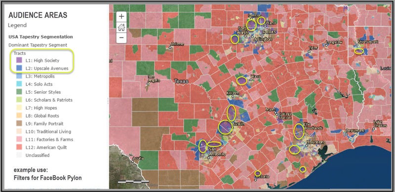
Innovations in modern cartography offer new tools for real estate professionals to connect with current and future clients.

Mapping technology has come a long way since the days Mapquest and Garmin ruled the lot. A host of open-data and proprietary tools offers real estate pros—both residential and commercial—new ways to share data about properties, local economic trends, and neighborhood amenities.
Free and low-cost products, including Leaflet, Google’s My Maps, CARTO Builder, and BatchGeo, can help you create custom maps of favorite neighborhood haunts, walking tours, or even comparable listings.
The results will surely get the attention of prospective clients, both online and offline.
Real estate professionals can take advantage of data that more and more municipalities are making publicly available about city services.
When hiring mapping professionals You need a mix of data scientist, designer, and geographer.
Mapping technology can also help real estate pros answer complex questions about their communities.
What if you want to know the specific locations in your community where a particular retail store will thrive based on socioeconomic factors and product demand? Or you may want to predict where future development may occur, so you’ll know where to concentrate your outreach efforts.
For questions such as these, the holy grail of mapping toolboxes may reside with Esri, a Redlands, Calif.–based company that owns the commercial licensing rights to Google Earth. Esri combines maps with other information such as census data, traffic counts, and consumer spending indices. The company uses that data to help real estate pros and their clients understand the market potential of an area.
Esri’s tools are integrated into the commercial segment of REALTORS Property Resource®.
The partnership allows users to finely tune their site selection analyses. “Let’s say a commercial real estate professional is working with a developer who is trying to find a location for a mixed-use community with apartments and retail space.
With a quick analysis of demographic, psychographic, and spending data, they can target areas with young, successful singles seeking urban lifestyles who spend their disposable income on dining out and shopping,” says Emily Line, vice president of commercial services at RPR. The presentation tools at RPR
Commercial allow users to predict how areas will develop and whether that growth looks sustainable according to demographic and economic statistics for the current state of the market as well as projections to 2020.
Big data can power decision-making from mapping large amounts of information in a way your clients can appreciate .
Source Meg White